Appearance
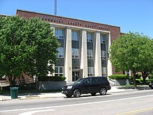
Urbana is a city in Ohio. It is the county seat of Champaign County.
Get in
[edit]By car
[edit]Urbana lies on US Route 68.
By plane
[edit]- 1 Grimes Field. A small general aviation airport.
By bike
[edit]The Simon Kenton Trail goes through West Liberty and Bellefontaine to the north, and to Springfield to the south.
Get around
[edit]See
[edit]


- 1 Urbana Monument Square Historic District. The downtown core of Urbana, with a number of Victorian buildings.
- 2 Champaign Aviation Museum. A museum dedicated to the history of Aviation, particularly during World War II. The museum is in the process of renovating a B-17 Flying Fortress as of 2018, and has a fully restored B-25, C-47, Stinson 10A, Fairchild F-24, A-26 Invader, and a C-45 Expeditor.
- 3 Johnny Appleseed Education Center and Museum, 518 College Way, ☏ +1-937-315-0656, info@johnnyappleseedmuseum.org. The largest collection of memorabilia and written information about the life of Johnny Appleseed aka John Chapman.
- Champaign County Historical Society Museum, 809 E Lawn Ave, ☏ +1 937-653-6721, champhistmus@ctcn.net. M Tu 10AM-4PM.
Do
[edit]- 1 Gloria Theater.
- 2 Champaign County Fair, 384 Park Ave, ☏ +1 937-653-2640. Early August.
Buy
[edit]Eat
[edit]- 1 Yutzy's Cheese House, 1522 US Hwy 36 E, ☏ +1 937-653-4282. A deli.
- 2 The Depot Coffee House, 644 Miami St, ☏ +1 937-653-3768.
- 3 Pappy's. A local pizza place.
Drink
[edit]Sleep
[edit]- Cobblestone Hotel & Suites - Urbana, 170 OH-55, ☏ +1 937-652-7828. Indoor pool, fitness center. Complimentary breakfast. $84 (Feb 2022).
Connect
[edit]- 1 Champaign County Public Library, 1060 Scioto St, ☏ +1 937-653-3811.
Go next
[edit]| Routes through Urbana |
| Findlay ← Kenton ← | N |
→ Springfield → Wilmington |


