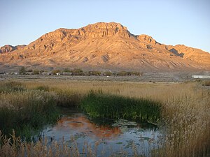
Cental Utah is a region of Utah, which includes the counties of Sanpete, Sevier, and Piute, as well as the eastern (east of longitude 113W) halves of Juab, Millard, and Beaver counties.
Cities
- 1 Beaver
- 2 Delta
- 3 Ephraim – Home of Snow College
- 4 Fairview – The Gateway to Skyline Drive. Fairview Museum.
- 5 Fountain Green
- 6 Gunnison
- 7 Manti – Location of the annual "Mormon Mircale Pageant"
- 8 Mayfield
- 9 Moroni
- 10 Mount Pleasant
- 11 Richfield
- 12 Spring City – The whole city is on the National Register of Historic Places.
- 13 Sterling
Other destinations

- 1 Cove Fort
- 2 Maple Canyon – Conglomerate rock climbing.
- 3 Palisade State Park – Golf, Fish, Swim, Canoe, Camp.
- 4 Little Sahara Recreation Area
- 5 Yuba Lake State Park – Waterski, Fish, and Camp.
Understand
Get in
Get around
Skyline Drive is a mountain road that winds for 87 miles along the spine of the Wasatch Plateau and is perhaps one of the highest roads in the nation. From the Skyline you can often see both sides of the mountain.
The Arapeen ATV Trail System is a great family trail with plenty of advanced sections for experienced riders. The trail system ascends from 6,000 to 10,000 feet through aspen and pine forests of the Manti-LaSal National Forest and includes the Skyline Drive and trails branching off from it. The Arapeen ATV Trail can be accessed from the west by using canyon roads that intersect with Heritage Highway 89 at every town between the cities of Fairview and Mayfield in the Sanpete Valley. From the east side of the mountain the trail can be accessed by taking canyon roads along Highway 10 from Huntington to Emery. Four-wheel-drive vehicles can traverse most of the trail, however various sections are to narrow or steep and require an ATV.
Go next
- Western Utah, which is to the west, has more desertlike country and is deeper inside the Great Basin.

