
Diving at Clifton Rocks

The dive site Clifton Rocks is an inshore rocky reef in the Clifton area on the Atlantic seaboard of the Cape Peninsula, near Cape Town in the Western Cape province of South Africa.
Understand
[edit]
Position
[edit]- 1 North west corner of Clifton Rocks: S33°56.346’ E018°22.222’
- 2 Entry point: S33°56.448’ E018°22.371’
- 3 Parking area: S33°56.487’ E018°22.415’
This site is in the Table Mountain National Park Marine Protected Area since 2004. A permit is required.
Name
[edit]The site "Clifton Rocks" is named for the large group of large rocks at the point at the southern end of Clifton fourth beach.
Depth
[edit]Maximum depth is about 14 m, average about 7 m
Topography
[edit]Granite corestone boulders of large size rising from about 10 m depth to in some cases 5 or more metres above the water. Many of the boulders are undercut at the bottom and resting on granite outcrops, so there are deep crevices and overhangs, several smallish swim-throughs and a few fairly narrow gaps. Surge can be strong at times in the gaps. The jumble of rocks gets denser and shallower to the south and surge and breaking waves can be quite impressive. Sand bottom to the north and inshore of the big rocks is mostly quite fine, with occasional areas of shells and coarse sand.
Geology: Huge granite boulders of the late Pre-Cambrian Peninsula pluton, with fine white quarz sand bottom
Conditions
[edit]The entry and exit area is exposed to north west swell, but protected from the south west. The dive site is exposed to both north and south west swell, which can be extremely turbulent in the narrow spaces between the rocks if large or long. There will almost always be some surge. The site will be best when the swell is low and short, which is often associated with south easterly winds. The site is usually at its best in summer, but there are also occasional opportunities in autumn and early winter.
Facilities
[edit]Parking may be a problem on weekends as the beach is very popular in summer and it is sheltered from the south Easter. Get there early.
Get in
[edit]

This is normally a shore dive. Turn off Victoria Road, Clifton, south of Fourth beach into The Ridge. Drive down to the furthest available parking area. The path to the rocks is at the sign for house #93. There is a narrow paved path with steps which passes between the plots and comes out on top of rocks facing to the north. Entry points are a few metres further along the point on large gently sloping north-facing rock with encrustation of black mussels. Entry and exit are easy, and well sheltered from south westerly swell.
Boat dives would usually be from the Oceana Power Boat Club slipway in Granger Bay, or the V&A Waterfront.
See
[edit]Marine life
[edit]Typical of the general area. Heavy kelp on rocks in gaps and on top of submerged rocks of shallow depth. The sea bamboo Ecklonia near the surface and the Split-fan kelp Laminaria in deeper water. There may be large numbers of bobtails on the sand, where they bury themselves and lie with only eyes exposed, until startled, when they dart off leaving a little cloud of ink.
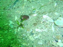 Large numbers of bobtails may be seen here at times
 Pale striped anemones
 Sponges on the reef


Features
[edit]Narrow gaps and swimthroughs, and a little enclosed inlet at the north western corner of the exposed rocks.
Photography
[edit]Fairly good site for photography. No specific equipment suggestions.
Routes
[edit]Surface swim out to the inshore side of the big rocks. Dive and swim around the big rocks anti-clockwise to the offshore side and to the last big rock. Depending on conditions, retrace your path or if a quiet day, make your way back in between the rocks or continue further south and west. These areas are shallow and can get very rough. At the north west corner of the high rocks there is a little inlet among the rocks which is quite pleasant. Return to the entry rock by compass across the sand bottom will take about 20 minutes if you have enough air.
Stay safe
[edit]Hazards
[edit]Cold water, Strong surge and breaking waves over exposed and shallow rocks. Sea urchins.
Skills
[edit]No special skills required. There are areas of sand bottom which would be suited to basic skills exercises, though the main dive site is a bit far for entry level trainees. This is a good area for snorkelling. A reasonable level of fitness is required for shore entries
Equipment
[edit]A light is useful to look into crevices, and a compass helps keep track of where you are, but is not essential.
Nearby
[edit]
- 1 Sea Point Ridge Pinnacles
- 2 Bantry Bay
- 3 North Lion’s Paw Main Reef
- 4 South Lion’s Paw
- 5 Cleeve's Tunnel
- 6 Bakoven Rock
Back to the Alphabetical list of sites, or list of dive sites in the Clifton area
Other regional dive sites:
- Dive sites of the Cape Peninsula west coast
- Dive sites of the Cape Peninsula east coast
- Dive sites of False Bay offshore and approaches
- Dive sites of False Bay east coast
- Fresh water dive sites of the Cape Town Metropolitan Area