Appearance
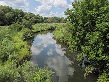
Reed City is a city of 2,500 people (2019) on the Hersey River in Northern Michigan.
Understand
[edit]Get in
[edit]By bus
[edit]Indian Trails provides daily intercity bus service from Grand Rapids (5 hr 20) and St. Ignace, Michigan (1 hr 25), as of Mar 2023.
By car
[edit]Reed City is at the junction of US Highways 10 and 131.
By bike
[edit]The White Pine Trail[dead link] runs from Grand Rapids to Cadillac and passes through Reed City. The Pere Marquette State Trail, running from Baldwin to Evart, also passes through town.
Get around
[edit]See
[edit]
Do
[edit]Buy
[edit]Eat
[edit]Drink
[edit]- Reed City Brewing Company, 141 W Upton Ave (Off the crossroads of US-10 and US-131), ☏ +1 231 465-4222. M 4-9:30PM, Tu-Sa 11AM-9:30PM, Su closed. A family-owned micro brewery with refreshing brews and homemade food.
Sleep
[edit]Connect
[edit]Go next
[edit]| Routes through Reed City |
| Manitowoc ← Ludington ← | W |
→ Clare → Midland |
| Petoskey ← Cadillac ← | N |
→ Big Rapids → Grand Rapids |


