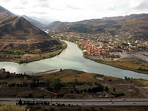
Kartli is a region in central Georgia containing Tbilisi, Mtskheta, Mount Kazbeg and the Georgian Military Highway.
Cities
[edit]
- 1 Tbilisi – the biggest, busiest and most popular city, as well as capital of Georgia
- 2 Bolnisi – formerly Katharinenfeld, famous for its history and Swabians settlers from Germany (try Hotel Deutsche Mühle for starters)
- 3 Gori – a city known for its Stalin cult and the nearby famous Uplistsikhe
- 4 Gudauri – mainly a popular ski resort
- 5 Khashuri
- 6 Kojori – former summer residence of the Georgian kings
- 7 Mtskheta – a UNESCO world heritage site
- 8 Rustavi – famous for its Sioni Church, and the Auto Trade Center, the biggest for used cars in the Caucasus
- 9 Stepantsminda / Kazbegi – famous for the spectacularly situated Gergeti Trinity Church
Other destinations
[edit]- 1 Kazbegi National Park – contains one of the highest mountains in Europe, Mount Kazbeg
Understand
[edit]Talk
[edit]Georgian is the principal language throughout most of Kartli, but there is a significant section of southern Kvemo Kartli (around Gardabani), where most residents are Azeri speakers and you may be able to communicate effectively with knowledge of Turkish. Speaking Russian will help best in areas where ethnic minorities live, where it is the lingua franca. It is spoken to various degrees by most older people, including by many taxi drivers, but this is no longer to be completely relied upon. The younger generation is increasingly speaking English due to hostility towards Russia, and also because English is taught in schools since independence and has replaced Russian as a second language in schools nation-wide. When in need for help, look for younger people, as they are more likely to know some English.
Get in
[edit]Bordering regions to the west are Samtskhe-Javakheti and Rioni Region, and to the east Kakheti, which all have numerous (mini)buses every day running into Tbilisi and by Gori as well as Mtskheta from its major destinations and cities (and vice-versa) – read there.
Likewise, Tbilisi is also the central hub for connections from/to Armenia (Ijevan, Sevan, Yerevan) and Azerbaijan (Ganja, Baku, Qax (Qakh), Zaqatala).
Get around
[edit]Generally, everything is true what is mentioned under the same section in the Georgia country article.
Bus-wise, most connections are explained under Tbilisi or under the above mentioned cities. Of course travelling by car is an option. Also hitch-hiking is very easy, even in remote regions.
See
[edit]- 1 Uplistsikhe – A 3,600 year old Silk Road cave city that was a major regional center of Caucasian pagan religion

- 2 Ananuri (60 km north of Tbilisi along the road to Gudauri and Kazbegi). A beautiful castle and monastery overlooking the Zhinvali Reservoir.
- 3 Trialeti and Algeti National Park, Nichbisi-Didgori-Didi Toneti Botisi (60 km west of Tbilisi). Close-by Algeti Lake.
- 4 Mineral Springs. Very interesting contrasts and colours created by the mineral water coming out of the ground. The water is also drinkable, a little bit like in Borjomi, but very iron-tasty. Some complain about the many tourists coming here—no wonder so close to the highway.
- 5 Dmanisi archaeological site (93 km southwest of Tbilisi). A bronze age settlement and the 1.8 million year-old fossilized remains of the first human in Europe have been discovered here.
- 6 Grakliani Hill (along the northern side of the highway between Tbilisi and Gori). Discovered during the widening of the Tbilisi-Senaki-Leselidze highway, evidence of human presence going back as far as 300,000 years.
- 7 Shatili. A remote and less visited mountain region. From here, hikes as well as tours with horses towards Omalo in Tusheti National Park can be undertaken, crossing the Atsunta Pass.
Do
[edit]- The 1 Georgian Military Highway – one of the world's more spectacular roads, the highway cuts through the Greater Caucasus and was built by the Russian Empire in the 19th century to facilitate its conquest of the Caucasus.
- Ski in Gudauri
- Hiking in one of the southwestern national parks and forests of Kartli, as well as in the Kazbegi region
Go next
[edit]Comprehensive details on transport options are available under Tbilisi#Get in.
The following regions and its destinations are next to Kartli:
- Samtskhe-Javakheti – Famous for Borjomi and Vardzia
- Rioni Region – Famous for Kutaisi, Chiatura and Oni
- Kakheti – Famous for David Gareja Monastery Complex, Sighnaghi, Gurjaani and the mountain region of Tusheti
Furthermore, Kartli, and especially Tbilisi, is the central hub for onward travel into Armenia and especially the following cities:
- Ijevan – The first destination when coming from Georgia / Tbilisi and popular for its post-soviet feel and the surrounding mountains
- Sevan – The nearby lake (biggest in Armenia) is a famous summer destination
- Yerevan – The capital, a must see and conveniently located for exploring Armenia
as well as Azerbaijan, and especially the following cities:
- Ganja – The first major city, coming from Tbilisi, and popular for its architecture and nearby hiking destination, Goygol National Park
- Baku – The capital, cosmopolitan and spectacular, best reached by night train
- Qax (Qakh) – A popular and remote city near the Caucasus, great for hiking into the Caucasus
- Zaqatala – Similar to Qax, though a little more touristic


