This is the Wikivoyage gazetteer. It gives information about the countries of the world in a way useful to the traveler, with maps, pictures, statistics, and climate data. It can also be used to access particular travel destinations around the world.
Understand
[edit]
Many atlases include a gazetteer that lists the countries of the world with general information about them, along with statistics like population, religious groups, and size of that country. Statistics in this Wikivoyage will be shown using the quickbar, which can also be found on Wikivoyage articles for each country around the world. Wikivoyage quickbars are designed to be useful to travelers, and therefore they include some additional travel-related information like currency and time zone in a way that is fairly easy to read. Quickbars will always be on the right side of the page.
There are also some pictures, static maps, and climate charts for countries in this gazetteer. The pictures will always include a caption beneath them. Static maps are maps of a particular country. They are designed by individual Wikivoyage users, and while they vary somewhat in formatting, they all have a fairly similar appearance. While they might show rivers, lakes, and other physical features, they are primarily political maps and therefore put more stress on the outline of a country, cities, and highways than mountain ranges, valleys, deserts or other such features found on some geographical maps. Finally, some countries in this gazetteer list have climate charts, which are diagrams that show the climatic trends for a certain place over a period of time.
In the next section is a list of all the countries of the world; each continental region of the world is listed in alphabetical order, and then each country is listed in the section for the corresponding continent in alphabetical order. Therefore, Africa is the first continent listed, and the first country listed is Algeria, in the same section as Africa.
Africa is the world's second largest continent, both in area and population, and also has the most countries of any continent. Africa's area is generally defined as stretching from the Mediterranean Sea in the north, across to the Suez Canal in the northeast, the Red Sea and the Indian Ocean to the east, and the Atlantic Ocean to the west. The continent of Africa is dry in the north (the main desert in the north is the Sahara Desert), tropical in the center, and then drier again in the south. Its most notable civilizations in ancient times were in the north along the Mediterranean Sea and included Carthage and Ancient Egypt. Ancient Egypt was a particularly advanced society, known for the construction of its great pyramids and its farming along the River Nile.
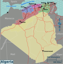
Algeria is Africa's largest country, with a coastline in the north along the Mediterranean Sea and large portions of desert in the south. These vast desert regions are part of the Sahara Desert, the largest desert in the world.
In the northern part of Algeria, there are mountains where a large portion of the people, along with the capital city of Algiers, can be found.
Neighboring countries include Morocco to the west and Tunisia and Libya to the east. To the south are the countries of Mauritania, Mali, and Niger. These countries also have large portions of deserts within their limits, and these desert regions are sparsely populated.
Despite most of Algeria's area being desert, it has quite a large population of nearly 40 million people, as demonstrated by the quickbar next to this paragraph.

Angola is another large African country. It is in the southwestern portion of Africa, north of Namibia and south of the Democratic Republic of the Congo. To the west is the Atlantic Ocean and to the east is Zambia. The capital city of Angola, Luanda, is on the western side of Angola, on the coast of the Atlantic Ocean.
Angola's population is about half of that of Algeria, with slightly over 20 million people living within its borders.
Angola is in the Southern Hemisphere, with the tropics to the north, and the deserts of Namibia to the south. Like the western coast of Chile in South America, this region of Africa can experience very dry weather in places, despite its location not far from the equator.
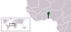
Benin is a small country in the tropical part of Africa near the equator. To the south is the Atlantic Ocean. To the west is another small country, Togo, to the north are Burkina Faso and Niger, and to the east is the much larger country of Nigeria.
The capital of Benin, Porto-Novo, is in the southern part of the country.
Surprisingly considering the small size of Benin, more than 10 million people live within its borders.
Botswana
[edit]Burundi
[edit]Chad
[edit]
Antarctica is a continent surrounding the southern end of the globe around the South Pole. Therefore, most of the continent is cold to very cold year-round and has practically no permanent population. Most of the people who live in Antarctica are scientists, and during the Antarctic "summer" their population is a few thousand. However, most of Antarctica is ice-covered, and therefore it is hard to set up permanent research stations or settlements.
Antarctica has no independent countries, so Antarctica's sub-gazetteer is divided into regions instead of countries.
South Georgia Island is a fairly large island between South America and Antarctica. However, it is Antarctic in its climate and appearance, and therefore is more a part of Antarctica than it is a part of South America. It has a very small population, but generally it is too ice-covered and cold to have a sizable permanent population.
Antarctic Peninsula and nearby islands
[edit]The Antarctic Peninsula and the surrounding islands, despite their location at the outer extremes of the Antarctic continent, are really like the heartland of Antarctica when it comes to science research. There are quite a few research stations in this part of Antarctica, and it is not as hard to temporarily stay in the region as it is to do so on the Antarctic Plateau.
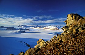
This region is dominated by the Antarctic Plateau — a large, fairly flat, ice-covered section of Antarctica that extends across pretty much all of the continent. Only along the coastlines does the Antarctic Plateau come to an end. Just off the coast of the Antarctic Mainland is a large island where Mount Erebus can be found, along with Antarctica's largest research station, McMurdo Station. On the Antarctic Mainland near McMurdo Station is one of the few regions of Antarctica that is not ice-covered; this region is known as the "McMurdo Dry Valleys".
Asia is the world's largest continent both in area and population. It stretches from Siberia in the north to India in the south, going from the Tropic of Cancer to north of the Arctic Circle. The wettest portions of the continent are in the south, with most of the rest of the continent having a lot of severe weather and deserts. The two most populous countries in the world, China and India, are in Asia, and both of these countries each have more than a billion people. To the north of Asia is the Arctic Ocean, to the east is the Pacific Ocean, and to the south is the Indian Ocean. It has a long history, which notable civilizations in Ancient India and China.
China is the country with the highest population in the world. It varies from the high deserts in the Tibetan plateau to the plains in the east and Manchuria in the northeast. The capital city, Beijing, lies between Manchuria and the plains of eastern China. Southern China consists of many mountain ranges, but the highest are found in the southwest in the Tibetan plateau, including part of the Himalaya Mountains. The highest mountain in the world, Mount Everest, is in the Himalaya Mountain range and is on the border of China and Nepal.
China has a long history that consists of many dynasties, or ruling families. These dynasties saw China rise and fall as an empire, but China did not reach its present size and shape until the Communist government took control in the late 1940s.
China borders many countries, including the other large nations of Russia and India. China's border with Russia is in two pieces due to Mongolia, a country that lies between Russia and China. China's border with India is in three pieces for similar reasons; the countries of Nepal and Bhutan come between China and India.

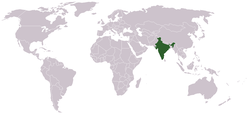
India, which has the second-largest population in the world for any country, is a fairly large country that has large tropical and subtropical regions, but also high mountains near Tibet. It has a long and interesting history, from the Indus Valley Civilization to British India, and now has a population of over a billion people and many large cities.
Much of India is on a peninsula that goes south towards the equator. On the northern side of the country, the Ganges River creates a large, low-lying valley. To the north of the Ganges River Valley is the Himalaya Mountain Range and the countries of Nepal and Bhutan. West of India is Pakistan and to the southeast is Bangladesh.
Indonesia is a nation made up of islands between Australia and the mainland of Southeast Asia.
Israel is known for being re-founded as a nation in 1948.
Iraq is a medium-sized country north of Saudi Arabia.
Laos is a country in the mainland of Southeast Asia, and is close to Vietnam and Cambodia.
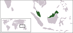
Malaysia is a country in two parts: most of the Malay Peninsula and about the northern 1/3 (excluding Brunei) of Borneo, the world's 3rd-largest island. Peninsular Malaysia is bounded in the north by Thailand. To the west are the Straits of Malacca and the Indonesian island of Sumatra beyond. To the south are the island nation of Singapore, which is connected to Malaysia by a causeway, a bridge and some shared history, and some small Indonesian islands. On the east is the South China Sea.
East Malaysia, mainly consisting of the states of Sarawak in the northwestern and north central part of Borneo and Sabah in the northeastern part, is bordered in the south by Kalimantan, part of Indonesia, and in the north in part by the Sultanate of Brunei. To the northeast of the state of Sabah, there is also a water boundary with the Sulu Islands of the Philippines.
The Philippines are a group of islands north of Indonesia.
Australia and New Zealand
[edit]Australia and New Zealand are two countries that don't particularly fit anywhere. Generally, Australia is regarded as its own continent, but that leaves out New Zealand. Therefore, in this gazetteer, these two countries have been grouped together since they share quite a few similarities: for example, they are both in the Southern Hemisphere and roughly the same region of the Southern Hemisphere. They are also both English-speaking. However, they do not have everything in common; Australia is much larger than New Zealand and is a lot more arid, while New Zealand has a fairly wet climate and consists chiefly of two large islands near each other.
Europe is not a huge continent, but since Greek and Roman times Europe has played a very important role on the world stage. It has no specific boundary with Asia, to the east, although generally the Ural Mountains of Russia are seen as the dividing line between the continents. The Mediterranean Sea marks Europe’s southernmost extent, and the Atlantic Ocean is to the east. The continent would generally be cold if it were not for the Gulf Stream, which comes in from the southwest and gives the western side of Europe a warmer climate. In the last 500 years Europe has seen the rise of multiple empires, including Spain and Portugal in the 1500s and Britain from the 1600s to the early 1900s. Most of the empires of Europe, however, conquered lands outside of Europe rather than building contiguous empires inside the continent — there were exceptions, however: Napoleon of France conquered much of Europe during the early 1800s before he was defeated and exiled.
Pacific Ocean (Oceania)
[edit]There are many islands in the Pacific Ocean that do not belong to any particular continent. These are generally east of Australia in the Southern Hemisphere, and these islands do not have a particularly large population. Hawaii is in the vicinity of these islands, but because it is part of the United States and is mountainous rather than flat like most of the Pacific Islands, in this gazetteer it will be counted as part of North America.
North America (Including Greenland)
[edit]North America, like South America, was a large continent unknown to most Europeans until fairly recent times (around 1500). Like Asia, it has a varied and, in many parts, a rugged landscape. Until the 1500s, it was inhabited by native tribes, but over the next few hundred years Europeans conquered and settled the land. The main North American countries are Canada, the United States, and Mexico, and in area they stretch from the northernmost parts of the Arctic to the tropics. Greenland, a large island that is almost like a continent of its own in size, is generally considered to be part of North America; however, it has a low population due to its high latitude and most of the continent is permanently covered by ice.
South America was the last continent (with the exception of Antarctica and Australia) to become known to Europeans. Much of the continent is tropical, although parts are dry and mountainous and the southern portions, which are not far from Antarctica, can receive cold weather. Until the Panama Canal was constructed in North America, sailors had to go around the southern end of South America if they wanted to go westward from the Atlantic to the Pacific Oceans. This was an extremely challenging journey for sailors to make and many sailors lost their lives either in the Strait of Magellan or between South America and Antarctica.


