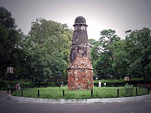
The Grand Trunk Road (GT Road) is one of Asia's great historical roads and a major route connecting Central Asia to the Indian subcontinent for at least 2,500 years. It is a 2,400 km (1,500 mi) stretch from Teknaf in southeast Bangladesh, across parts of India and Pakistan, to Kabul in Afghanistan.
Rudyard Kipling describes it in his novel Kim:
And truly the Grand Trunk Road is a wonderful spectacle. It runs straight, bearing without crowding India's traffic for fifteen hundred miles—such a river of life as nowhere else exists in the world. They looked at the green-arched, shade-flecked length of it, the white breadth speckled with slow-pacing folk...
In 2015, the "Sites along the Uttarapath, Badshahi Sadak, Sadak-e-Azam, Grand Trunk Road" were submitted to the tentative list of UNESCO World Heritage Sites. The sites along the historic road in the World Heritage List include Agra, Delhi, Lahore and Taxila.
Understand

There was trade along parts of the route far earlier, but the road became clearly established during the Maurya Empire (322–185 BCE) when it was known as uttarapatha (road to the north) and ran from the mouth of the Ganges (near what later became known as Calcutta and is now called Kolkata), through the Empire's capital in what is now Patna, then via the then-great trading city Taxila and through Afghanistan, all the way to the Central Asian region of Bactria.
Later Indian rulers, especially the Mughals, did quite a lot of work on upgrading the Kolkata-Kabul part of the road and later extended it east into what is now Bangladesh. However, the Kabul-Bactria section was not considered part of their Grand Trunk Road since Afghanistan was outside their influence.
The British also improved the road when they ruled India and, after the British left, the various nations along the route have done so as well.
There are several highways that largely correspond to the historic Grand Trunk Road. This itinerary covers the British-era Grand Trunk Road from Howrah to Kabul.
Get in
One has to reach Howrah in India to begin the journey from the eastern terminus of the route. One can also begin the journey from its western terminus at Kabul in Afghanistan.
Route
The itinerary is presented here from east to west. State highways in India are referenced by their ISO abbreviations, e.g. WB 13 means West Bengal State Highway 13.
The route starts from Howrah and heads northeast and then to several cities along the Hooghly River. After that, it turns northwest to the regions of Rural Hooghly and Rarh. Here, the road coincides with WB 6, WB 13 and NH 19.
- 1 Howrah — Kolkata's twin city, with the largest railway complex in India
- 2 Serampore — a former Danish colony
- 3 Chandannagar (Chandernagore) — a former French colony, famous for Jagaddhatri Puja and the immersion rally
- 4 Hooghly — historic port city, home to Bandel Church
- 5 Bansberia — famous for Hangseshwari Temple
- 6 Rural Hooghly — rural area dotted with numerous temples and other attractions
- 7 Bardhaman (Burdwan) — a major agricultural city, known for its rich culture and sweetmeats
- 8 Durgapur — a major industrial city
- 9 Asansol — a major industrial and mining centre


After Amritsar, one has to cross the India-Pakistan border, which has been closed and reopened many times since Partition, so check beforehand. The GT Road crosses this border at Wagah, and that is usually the only place where crossing by road is allowed.

- 22 Rawalpindi — military headquarters
- 23 Taxila (Takshashila) —
- 24 Peshawar — gateway to Khyber Pass

Due to the hostile situation in Afghanistan, one can skip this part of the route and can stop the journey in Peshawar to avert any risk associated with entering Afghanistan overland.
The route crosses the Khyber Pass.
Alternative routes
From Bangladesh
In the 16th century, Sher Shah Suri re-aligned the original Grand Trunk Road at Sasaram in present-day Bihar towards Sonargaon in present-day Bangladesh. Various sources also put the eastern terminus of the GT Road at Teknaf in Bangladesh instead of Howrah in India.
Along Delhi–Kolkata Road
The Delhi–Kolkata Road runs from Dankuni (near Kolkata) to Delhi and bypasses several cities and towns. The Dankuni–Agra section of the road is labelled NH 19, while the Agra–Delhi section is labelled NH 44. NH 19 is world-class, a 4 lane highway with a divider. Earlier, the Panagarh stretch used to have traffic jams, but as of 2017, there is a bypass avoiding Panagarh Bazar.
Eat
There are numerous dhabas (restaurants) by the Grand Trunk Road. As with truck stops in other countries, these generally serve plain fare at moderate prices, and you can often recognise the better ones because they are quite busy. The food will not usually cause travellers' diarrhea because it is kept hot and in busy places not kept long, but much of it is likely to be too spicy for some visitors.
All these places have many options for vegetarians, always the standard cheap meal of roti (flatbread) and dahl (lentils) and usually rice, other breads, and curries based on other vegetables or panir (feta-like cheese). Most will also have some dishes using mutton, chicken, or sometimes goat. Beef is taboo for Hindus and pork for Muslims, so those are not usually available.
Stay safe
Parts of this route are in Afghanistan which, as of early 2023, is quite unsafe. The border region of Pakistan, Khyber Pakhtunkhwa, is also risky. For details, see the linked articles.
Go next
- After reaching Kabul, one can go further west and eventually arrive at Istanbul overland
- From Kabul, one can also go north across the Hindu Kush toward Bactria and the rest of Central Asia
- The Karakoram Highway runs from Pakistan to Kashgar in western China. To take it, one could start from Rawalpindi, which is on the GT Road


