
Talk:South Island
Add topicTemperatures
[edit]"temperatures are routinely in the 30°C's in summer" - dubious —The preceding comment was added by 60.234.252.150 (talk • contribs) at about 23:57, 10 August 2008
Max temperatures certainly in Canterbury, Marlborough and Central Otago - Rimu —The preceding comment was added by (WT-en) Rimu (talk • contribs) at about 08:08, 12 August 2008
- Agreed - i think key weather point as with all NZ is the variability Armin-t (talk) 21:48, 22 January 2013 (UTC)
- Precisely.
- However, I have shortened your bit about winter temperatures and snowfall for a number of reasons:
- 1) Brevity in the lead. (You're very welcome to add an "Understand" section with some detailed monthly averages in a table for, say Nelson, Westport, Queenstown, Christchurch, Dunedin and Invercargill)
- 2) Reducing the negativity - otherwise we find people on SQ flights into CHC lugging snowshoes with them!
- 3) Balance. It "rarely does drop much below zero" in most population centres in most winters (with notable exceptions, of course). -- Alice✉ 22:34, 22 January 2013 (UTC)
- Agreed - i think key weather point as with all NZ is the variability Armin-t (talk) 21:48, 22 January 2013 (UTC)
- Happy to shorten but (A) I don't see snow as a negative thing and I think its worth mentioning that it does happen occasionally and helps to give a quick heads up, although could add something about it generally melting quite quickly. (B) In winter its regularly below 0 overnight in chch, timmers, queenstown and many other places [] - chch has on average 99 days of frost per year.Armin-t (talk) 00:11, 23 January 2013 (UTC)
- Both correct. However, I still think that the vague phrase ""rarely does drop much below zero" is also correct since even in "chch, timmers, queenstown" the temperatures are still not much below zero, but rather only a couple or so degrees. Keep up the good work! -- Alice✉ 02:04, 23 January 2013 (UTC)
- I get the vibe you have quite a bit of an ownership feel over these articles and its quite frustrating to work with. Almost every change I make you come in and comment/change. Its obviously helpfully to have the style of things tidied up, but sometimes it seems a little pedantic, and I have to say in this case you a wrong. We need to put the correct information there, without any rosy glow on it. In any standard use of the word 99 out of 365 classes as more than 'rarely'. If a traveller were to turn up in Christchurch in June/July/August they would find that it is below zero, most nights from around 7pm till 9 in the morning - to me that is 'below zero regularly overnight during winter' - and the information as it stands on the page is wrong. Also the other regions do not always have 'good' snowfall every year (except in alpine regions), especially nelson lakes (which links to nelson bays, technically different) where I would say snow is a rarity during winter. Where are you getting your information from? I wont change it back yet as that would be childish but would appreciate if someone else could weigh with some perspective?Armin-t (talk) 19:54, 23 January 2013 (UTC)
- You're broadly right on all major scores, Armin-t, and I'm glad you've brought your concerns here to the correct place where we can try and improve our South Island article by a process of discussion and consensus building. My profound apologies if I have caused you to feel frustrated!
- Yes, feeling (and, even worse, exhibiting) a degree of "ownership" is a constant danger that I, like many of our more frequent and long-term editors succumb to from time to time (sometimes it's the flip, nasty side of putting in long hours checking facts, finding suitable images and trying to hone prose). Thanks for the salutary reminder!
- Often the lead paragraph can be a point of contention, because here we aim for the right tone, encouraging readers to consider visiting the destination, while all the time striving to be both fair and not too prolix. I think we can err a little on the side of being positive in the lead paragraph - and balance things out a bit with some objective facts in the sections underneath.
- As always, the devil is in the detail.
- If the phrase in the lead had been :
- In winter, the sea buffers temperatures which rarely drop below zero (32°F) — except in the mountains... then you would have been entirely accurate in writing In any standard use of the word, 99 out of 365 days in the year, classes as more than "rarely"
- However, if you read carefully, the actual phrase you complain of was subtly different:
- "In winter, the sea buffers temperatures which rarely drop much below zero (32°F) — except in the mountains..." (my emphasis added)
- If we define "much below zero" as meaning temperatures more than five degrees below zero Celsius, then none of the major population centres of the South Island average more than a few nights per year "much below zero"!
- In fact, the place with second greatest number of frosts each year in NZ, Alexandra, rarely averages more than 2 degrees below!
- I do encourage you to continue to provide the accurate detail in the "Understand" section, though, as you've already been doing...
- Your point about snowfall is very valid and I have changed the lead accordingly. (My aim was to try and give a hint to travellers from tropical countries like, Singapore, Malaysia, India and Thailand that they did not inevitably risk frostbite if they ventured south of the Bombay Hills). In editing your amendment to this part of the lead I failed to double check my edit and left the lead giving a misleading impression, which I hope I have now rectified. All of the major ski areas of the South Island have been able to rely on significant snow fall each winter - whether that will change due to global warming is another question of course...
- If the lead is still misleading and unbalanced, I would encourage you to bring your proposed wording here (the whole lead paragraph, please) where we can all discuss improvements.
- As to your point about the internal linking of Nelson Lakes: at the moment probably the only alternative would be to link to Murchison-Nelson Lakes. Unfortunately (and not surprisingly, since it is a rather unnatural pairing) that article is only a most unhelpful stub right now - and scheduled to disappear completely as a sub-region if my proposals below are adopted.
- I get the vibe you have quite a bit of an ownership feel over these articles and its quite frustrating to work with. Almost every change I make you come in and comment/change. Its obviously helpfully to have the style of things tidied up, but sometimes it seems a little pedantic, and I have to say in this case you a wrong. We need to put the correct information there, without any rosy glow on it. In any standard use of the word 99 out of 365 classes as more than 'rarely'. If a traveller were to turn up in Christchurch in June/July/August they would find that it is below zero, most nights from around 7pm till 9 in the morning - to me that is 'below zero regularly overnight during winter' - and the information as it stands on the page is wrong. Also the other regions do not always have 'good' snowfall every year (except in alpine regions), especially nelson lakes (which links to nelson bays, technically different) where I would say snow is a rarity during winter. Where are you getting your information from? I wont change it back yet as that would be childish but would appreciate if someone else could weigh with some perspective?Armin-t (talk) 19:54, 23 January 2013 (UTC)
- Both correct. However, I still think that the vague phrase ""rarely does drop much below zero" is also correct since even in "chch, timmers, queenstown" the temperatures are still not much below zero, but rather only a couple or so degrees. Keep up the good work! -- Alice✉ 02:04, 23 January 2013 (UTC)
- Happy to shorten but (A) I don't see snow as a negative thing and I think its worth mentioning that it does happen occasionally and helps to give a quick heads up, although could add something about it generally melting quite quickly. (B) In winter its regularly below 0 overnight in chch, timmers, queenstown and many other places [] - chch has on average 99 days of frost per year.Armin-t (talk) 00:11, 23 January 2013 (UTC)
- Thanks again for bringing your concerns here; is there a particular part of NZ you know/like best? Otago perhaps? If so, perhaps you would care to contribute to the discussions below on the "regionalisation of the South Island in our articles"? -- Alice✉ 22:33, 23 January 2013 (UTC)
- Again - ill defer to whatever a 3rd party thinks here rather than locking horns. I just worry that we give the impression of it being relatively warm (and from all the travelers I have chatted to overseas, the majority seem to assume we have a climate closer to that of Australia rather than the cooler and varied climate we actually have). I think the possibility of encountering snow over winter (and sometimes summer) in central and southern regions, and cooler temperatures overnight are key things to raise for any traveler who might make false assumptions about the warmth. I'm from otago but have lived in queentown and timaru, wellington and others, and have been pretty much everywhere in the south island. Also I recommend removing the nelson lakes as a ski region - the one ski field there - rainbow - is pretty small not really in the same class as those in Canterbury and qt (im pretty sure from memory that it fails to open some seasons due to lack of snow).Armin-t (talk) 23:15, 23 January 2013 (UTC)
- I think this is down to your own personal experiences. Most of the (diminishing number of) Japanese that I speak with on SIN-CHC-SIN flights are well aware that climatically the two islands are quite similar but with winter temperatures away from the mountains in the South Island more moderate than Honshu (and certainly Hokkaido). The German speakers (like many Japanese in the southern Winter) are usually very well informed (as are the Brits and Canadians) and often specifically come for Alpine and Alpinist activities. The Aussies I don't meet too many in my line of work but I would be amazed if they were more ignorant than US visitors. That's why I have tended to write for the "tropical ones" as above. It's good that you have added to our "Stay safe" section in this regard.
- I'm not sure that the business people of St_Arnaud would agree with your categorisation, but then we don't write WV with their perspective too much in mind. Rainbow Field is definitely not in the same commercial league as the ones in either Otago or Canterbury but if you actually check the snowfall figures, it actually gets more consistent snowfalls (as was pointed out to me by no less than the Austrian downhill ski champion on one SQ flight when I queried his destination - he also liked the club atmosphere and the relative cheapness). Certainly Rainbow Field does not have the snow-making machines that the larger, more commercial areas are able to fall back on in some weeks. -- Alice✉ 23:40, 23 January 2013 (UTC)
- (a) agreed, there are different perspectives so you cant play to either. As a travel guide it should be balanced. Put in both - "temperatures quite often drop below zero overnight in winter (though rarely by much)." or something along those lines.
- (b) One ski field ≠ ski area. There are dozens of great small club fields of a similar size to Rainbow throughout the southern alps (north and south Canterbury, mackenzie country) which would not rate as 'ski areas'. So we need to chose, include all of them in the listing, or only the main commercial regions (queenstown and canterbury around hutt). It would seem wrong - and misleading - to favor the 'business people of St_Arnaud' over the business people of Fairlie, Tekapo and Ohau. Armin-t (talk) 00:38, 24 January 2013 (UTC)
- (b): Fair point, but what will be a new Nelson Bays region (if my proposal below is not vehemently opposed) still has other 'ski areas' besides just the Rainbow (club) Field. Mount Robert for example: this sort of "high roller, top dollar" skiing should not be totally discounted. Please understand that the lead paragraph for the whole South Island is necessarily short but we definitely have the space (and policy) to list every single field (and heli-skiing opportunity) at the local article level, and I actively encourage you to do just that. -- Alice✉ 01:35, 24 January 2013 (UTC)
- Sigh. That was the roundabout way of making my point - since we don't want to put too much in the header - just include the main 2 areas, don't include the smaller areas, and especially don't just include one smaller area (Nelson-Lakes) at the expense of others. As it is it gives the impression that Nelson lakes is a ski region on par with Canterbury and qt, which is incorrect and misleading. I only bother to change these things when it looks like they are clearly misleading. Anyway I'm out, agree to disagree, more useful things to spend my time on and whatnot. I just don't understand why when we clearly have opposing view on this, even if its 50/50, you might not consider that maybe the person who lives in the country and has been to most of the ski fields could know what they are talking about. Armin-t (talk) 01:50, 24 January 2013 (UTC)
- (b): Fair point, but what will be a new Nelson Bays region (if my proposal below is not vehemently opposed) still has other 'ski areas' besides just the Rainbow (club) Field. Mount Robert for example: this sort of "high roller, top dollar" skiing should not be totally discounted. Please understand that the lead paragraph for the whole South Island is necessarily short but we definitely have the space (and policy) to list every single field (and heli-skiing opportunity) at the local article level, and I actively encourage you to do just that. -- Alice✉ 01:35, 24 January 2013 (UTC)
- Again - ill defer to whatever a 3rd party thinks here rather than locking horns. I just worry that we give the impression of it being relatively warm (and from all the travelers I have chatted to overseas, the majority seem to assume we have a climate closer to that of Australia rather than the cooler and varied climate we actually have). I think the possibility of encountering snow over winter (and sometimes summer) in central and southern regions, and cooler temperatures overnight are key things to raise for any traveler who might make false assumptions about the warmth. I'm from otago but have lived in queentown and timaru, wellington and others, and have been pretty much everywhere in the south island. Also I recommend removing the nelson lakes as a ski region - the one ski field there - rainbow - is pretty small not really in the same class as those in Canterbury and qt (im pretty sure from memory that it fails to open some seasons due to lack of snow).Armin-t (talk) 23:15, 23 January 2013 (UTC)
- Thanks again for bringing your concerns here; is there a particular part of NZ you know/like best? Otago perhaps? If so, perhaps you would care to contribute to the discussions below on the "regionalisation of the South Island in our articles"? -- Alice✉ 22:33, 23 January 2013 (UTC)
I think you may be missing my points, Armin-t:
- Suggest your new lead paragraph below - the whole finished thing - not just isolated phrases. That way we can all try and get the balance just right.
- This is not the article about Skiing the South Island - it would be great if you could write this travel topic. This is the lead of South Island and this is just a fleeting mention that one can ski here (in the context of very briefly hinting at the South Island climate).
Anyway, I now see that you have just removed a whole future region from the suggestion that there could be great skiing there too — so obviously we will have to agree to disagree. No big deal, I'm sure the new (and possibly re-named) Nelson Bays region will list the comprehensive ski possibilities. -- Alice✉ 02:06, 24 January 2013 (UTC)
- I'm not sure we should be making all these references to climate and specific ski areas in the lead. I think it's important to mention climate, including that it gets below zero sometimes, but climate info is usually placed in the Understand section. With the ski areas, I think it's too specific for the lead. There's so many things to do in the South Island, I think we do the island more justice if we talked up a range of the activities instead of focusing on the specifics of one. I propose we re-write the last paragraph (see below) and move the Climate info to Understand and put more detailed info about ski areas in the Do section.
- But the South Island is more than just stunning scenery. Hike (or tramp, as the locals say) through unspoilt valleys, lay down fresh tracks at the many ski fields, get your adrenaline going at a bungee jump or kayak to golden sand beaches. Your visit to the South Island can be as tame or as adventurous as you want.
- Feel free to make any improvements. -Shaundd (talk) 05:09, 24 January 2013 (UTC)
- I'd be entirely happy with that as the replacement paragraph, Shaundd - it's got a great, up-beat tone to it and nobody could possibly quibble that it's inaccurate. As far as I'm concerned, that replacement last paragraph's got my vote, but it might be politic to
- 1) wait 48 hours to see if there's a contrary stance
- 2) suggest what exactly is being moved into the "Understand" and "Do" sections
- just to forestall any future quibble. Thanks for a much better paragraph! -- Alice✉ 06:14, 24 January 2013 (UTC)
- sounds great - do it. Looks like at some point someone has gone through and added some serious love to nelson region in the article (at the expense of the rest of the island). Might go through this weekend if I get round to it and balance it out somewhat Armin-t (talk) 19:57, 24 January 2013 (UTC)
- Thanks. Here is my suggested wording for the climate info, which will go in the Understand section. Over time, this should probably be fleshed out more (it seems a little Canterbury and Otago-centric right now) but I think it's good enough for now. I tend to agree with Armin-t and think we need to cover the winter stuff more. My own experience chatting to travellers about NZ's climate is mixed. Those who are heading to the South Island to ski have a good grasp of what the weather will be like, but people just generally backpacking/touring around, not so much.
- The South Island generally has a cooler and more invigorating climate than the North Island but don't forget sun hats and t-shirts — temperatures can often reach in the high 20's and low 30's (more than 86°F) in summer and Nelson regularly tops New Zealand's sunshine league table. In winter, the sea buffers temperatures in coastal areas, but it can drop below zero overnight (32°F) — although rarely by much. Snow occasionally falls along the coast, particularly in the south, and is common in the mountains. The West Coast can have beautiful warm sunny days in summer, but it is also quite wet with much of the coast receiving over 2000 mm of rain per year.
- And here is my suggested wording for the ski stuff that would go in the Do section:
- All those mountains provide ample terrain for snow enthusiasts, so it's not surprising there are many ski fields in the South Island. While not as large as the resorts in North America or Europe, they provide a good mix of terrain. The largest ski areas are near Queenstown, Wanaka and Methven. Small "club" fields — with fewer facilities but less crowds — can be found in Nelson Bays and the Mackenzie Country.
- Please feel free to suggest changes. Cheers -Shaundd (talk) 06:59, 25 January 2013 (UTC)
- None needed from my perspective, Shaundd. Two sparkling and accurate paragraphs. -- Alice✉ 07:57, 25 January 2013 (UTC)
- Such nice writing and a style to aspire to, Shaundd, I can barely bring myself to quibble over the apostrophes for the plurals "20's" and "30's". Nurg (talk)
- Main page is updated, without the apostrophes. :-) -Shaundd (talk) 18:34, 26 January 2013 (UTC)
- Maybe - snow occasionally falls in coastal regions. I think its good, but in general my thoughts are it might be clearer if it notes a little more the difference between the 3 climate areas - coastal being temperate/changeable, inland (and elevated) being changeable but generally a little dryer, with warmer summers, cooler winters (and perhaps mentioning mountain passes and the fact they are occasionally closed by snow)- and the west coast, having its own unique system with huge amounts of rain due to the effect of the Alps on westerly winds. Thoughts? —The preceding comment was added by Armin-t (talk • contribs) at about 00:48, 28 January 2013 (UTC)
- Now that you have a whole new sub-section to add detail to (South_Island#Climate), I would suggest that we let Shaundd's sparkling and balanced paragraph stand unchanged as a lead paragraph in that sub-section and add any necessary detail(s) in a separate paragraph(s) below.
- It's definitely a good idea in my opinion to try and categorise and I would still encourage you to bring your proposed new paragraph(s) here - the whole finished thing - not just isolated phrases. That way we can all try and discuss improvements and get the balance just right. -- Alice✉ 01:07, 28 January 2013 (UTC)
- The South Island generally has a cooler and more invigorating climate than the North Island but don't forget sun hats and t-shirts — temperatures can often reach in the high 20's and low 30's (more than 86°F) in summer and Nelson regularly tops New Zealand's sunshine league table. Temperatures generally become cooler the further south you go - but you can still experience the classic New Zealand "four seasons in one day" in any corner of the island. Coastal regions are generally milder as the sea buffers temperatures. Elevated regions in the center of the island have a more alpine climate, being cooler in winter, warmer in summer and having less rainfall, with many of the mountains permanently capped with snow.
- In winter, snow fall is common in central elevated regions (occasionally leading to the temporary closure of roads). During winter snow also occasional falls down to sea level, and even coastal regions temperatures can often drop below zero overnight (32°F) — although rarely by much.
- The west coast of the South Island also has its own unique weather system. Westerly air flow from the Tasman Sea rises as it hits the mountains. This results in a large amount of rain, with much of the area receiving over 2000 mm per year. The rain does have its benefits though, supporting the lush temperate rain forests of the Fiordland Region. Thoughts? Armin-t (talk) 04:34, 28 January 2013 (UTC)
- Fine, I'd just make some slight changes, principally for NZ spelling and grammar so that the three paragraphs then become:
- The South Island generally has a cooler and more invigorating climate than the North Island but don't forget sun hats and t-shirts — temperatures can often reach in the high 20's and low 30's (more than 86°F) in summer and Nelson regularly tops New Zealand's sunshine league table. Temperatures generally become cooler the further south you go - but you can still experience the classic New Zealand "four seasons in one day" in any part of this island. Coastal regions are generally milder because the sea buffers temperatures. Elevated regions in the centre of this island have a more alpine climate, being cooler in winter, hotter in summer and having less rainfall, with many of the mountains permanently capped with snow.
- In winter, snowfalls are common in central, elevated regions (occasionally leading to the temporary closure of roads). During winter, snow also occasionally falls down to sea level and even coastal region temperatures can often drop below zero overnight (32°F) — although rarely by much.
- The West Coast of the South Island also has its own unique weather system. Westerly air flow from the Tasman Sea rises as it hits the mountains. This results in a large amount of rain, with much of the area receiving over 2000 mm per year. This rain does have its benefits though, supporting the lush, temperate rain forests of Fiordland. -- Alice✉ 05:55, 28 January 2013 (UTC)
- Maybe - snow occasionally falls in coastal regions. I think its good, but in general my thoughts are it might be clearer if it notes a little more the difference between the 3 climate areas - coastal being temperate/changeable, inland (and elevated) being changeable but generally a little dryer, with warmer summers, cooler winters (and perhaps mentioning mountain passes and the fact they are occasionally closed by snow)- and the west coast, having its own unique system with huge amounts of rain due to the effect of the Alps on westerly winds. Thoughts? —The preceding comment was added by Armin-t (talk • contribs) at about 00:48, 28 January 2013 (UTC)
- Main page is updated, without the apostrophes. :-) -Shaundd (talk) 18:34, 26 January 2013 (UTC)
- Such nice writing and a style to aspire to, Shaundd, I can barely bring myself to quibble over the apostrophes for the plurals "20's" and "30's". Nurg (talk)
- None needed from my perspective, Shaundd. Two sparkling and accurate paragraphs. -- Alice✉ 07:57, 25 January 2013 (UTC)
- Thanks. Here is my suggested wording for the climate info, which will go in the Understand section. Over time, this should probably be fleshed out more (it seems a little Canterbury and Otago-centric right now) but I think it's good enough for now. I tend to agree with Armin-t and think we need to cover the winter stuff more. My own experience chatting to travellers about NZ's climate is mixed. Those who are heading to the South Island to ski have a good grasp of what the weather will be like, but people just generally backpacking/touring around, not so much.
- sounds great - do it. Looks like at some point someone has gone through and added some serious love to nelson region in the article (at the expense of the rest of the island). Might go through this weekend if I get round to it and balance it out somewhat Armin-t (talk) 19:57, 24 January 2013 (UTC)
Regions
[edit]As part of drawing the map for the South Island, I'm thinking of tweaking the regions. The current ones look a bit unbalanced so I'm proposing to shrink the current six top level regions to four as follows:

- Tasman-Marlborough - Combine the current Marlborough (New Zealand) and Nelson Tasman regions. I'd create four subregions -- North Marlborough, South Marlborough, Nelson Bays and Murchison-Nelson Lakes -- which corresponds to the four very distinct areas of region.
- Canterbury - The existing Canterbury (New Zealand) guide.
- West Coast - The existing West Coast (New Zealand) guide.
- Otago and Southland - Combine the existing Otago and Southland guides. There would be three subregions -- Otago (the coastal area + Central Otago), Queenstown-Lakes (the lakes & mountains area of Otago) and Southland.
This breaks the island into four good-sized chunks that are related geographically and travel-wse: the top of the island, the southern part, east of the Southern Alps (i.e., the Canterbury Plains) and west of the Southern Alps (West Coast). The borders for the travel regions would follow the borders of the equivalent official administrative regions.
Any thoughts/concerns? -(WT-en) Shaund 09:20, 30 August 2011 (EDT)
- I've gone ahead and implemented this (with some minor changes). - (WT-en) Shaund 00:34, 22 November 2011 (EST)
- I disagree. The six regions were good and fit perfectly with the 7±2 rule. The only reason given for change was that they "look a bit unbalanced". I don't know what that means. And I don't think it was a problem. Four regions is outside the 7±2 guideline. The change has added an unnecessary level in the hierarchy. I don't see any good reason to have to go South Island > Tasman-Marlborough > Marlborough; or South Island > South (New Zealand) > Southland. Tasman-Marlborough and South have only three subregions, and the South Island has only four – so the whole structure doesn't follow the 7±2 guideline. I suggest reverting to the old six region structure which was perfectly good. Nurg (talk) 22:11, 14 December 2012 (UTC)
- The "unbalanced" comment referred to the relative sizes of the regions and levels within them. Marlborough and Nelson, on their own, are very small compared to Canterbury or the West Coast. And if I recall correctly, the old six region structure had three regions with sub-regions and three that didn't.
- The main reason why I suggested the changes was because I thought it better broke the South Island down into groups of regions that would make sense to someone who hasn't been there before. Nelson and Marlborough are often visited together so my idea was a combined top-level region article (when complete) would better explain the whole top bit of the island. The same applies for the South. The three main draws are (I believe) Queenstown, Fiordland and Dunedin, and I would think it is common to do them together -- so grouping them into one broad region makes sense. I also wanted to make the Queenstown region more prominent. I know it's part of Otago at some administrative level, but from a traveller's perspective, I think it's sufficiently different and attractive as a destination that it shouldn't be just another subregion of Otago.
- I still think the four regions are better, but if we undid it, I'd like to see Queenstown-Lakes raised to a top-level region. That would make seven top regions, so it's still OK from the 7±2 perspective (which is just a guideline, there are many instances where there are only three subregions to a region). -Shaundd (talk) 07:34, 16 December 2012 (UTC)
- My proposition would be to restore Nelson-Tasman and Marlborough (but to include Kaikoura) as separate regions and have a Queenstown-Lakes region including Cromwell and Wanaka AND a Southland region encompassing Te Anau, the Catlins and Invercargill (at least until the Routeburn tunnel is finished). That would be 7 regions, none of which is too small for a 4 night sojourn. I've also been bold and ordered the settlements ("cities") from north to south (rather than the old semi-alphabetical order with CHC at the head - at least until the earthquake re-build starts...) -- Alice✉ 23:42, 21 December 2012 (UTC)
Here is a question, where do you draw the line around the queenstown lakes region? My suggestion would be to include Te-Anau (as that is usually considered in the same trip and visited along with queenstown, so makes sense for someone looking at that page). Cromwell could go either way (queenstown lakes or central), it is beside a lake and is forms a triangle with qt and wanaka although it does not have the same tourist character of those two and is closer to central in its vibe (although it does have some wine/orchard related tourist stuff and seems to be getting more). Armin-t (talk) 22:04, 22 January 2013 (UTC)
- Here's my concrete proposal then:
- 1) Scrap both the hierarchical division and sparse stub of South (New Zealand)
- 2) Our articles on Queenstown-Lakes, Southland and Otago then become the basis for 3 of the new 7 regions of southern New Zealand (the other 4 being Canterbury, West Coast, an expanded Nelson Bays that also includes our Murchison-Nelson Lakes article, and an expanded Marlborough-Kaikoura region that includes both the Marlborough (New Zealand) and Kaikoura articles).
- 3) I propose drawing the straight line southern boundary of an expanded Marlborough-Kaikoura region west, west by north-west from Pinnacle Rocks (just to the South of Kaikoura aerodrome on SH1) to the junction of Stag and Spey Road with the Inland Kaikoura Road (near Charwell Forks) and then in the same smooth line to re-join the Marlborough/Canterbury political boundary at the Acheron River where it flows north east (ie broadly paralleling the old Victorian Nelson Province boundary) — or we could just use the existing political boundary of the Kaikoura District of Canterbury (this is more convoluted, follows the Clarence River and is a bit further south in some places).
- 4) To answer your points, I would move Cromwell (and his head - huge grin) into the new Queenstown-Lakes region since many people (if they don't take the vastly improved Crown Range Road) will drive that way and the natural gateway is ZQN rather than DUD.
- I would most definitely keep Te Anau in the restored Southland region - (at least until/unless the Routeburn tunnel is finished) if only to assist in stopping that dreary and fuel guzzling procession of coaches filled with slumbering Koreans missing the scenic delights of one of the greatest road journeys in the world along the Milford Road!
- The current political boundary between Otago and Southland occurs on SH6 south of Fairlight and just north of Garston (ie well south of the Kingston Flyer terminus) and that is a natural tourist oriented boundary for our regions too.
- I'll try and learn how to draw a new map - unless someone here already knows how to do this?
- v) Just for the sake of completeness and to put all my cards on the table, my fourth (and long term) proposal (and obviously this would need to be discussed at the whole Realm of New Zealand level rather than here) would be to divide New Zealand into only two super divisions of North and South. The North would be identical to our North Island article as it is now (except for the addition of the Kermadec Islands) and then, for the new South super division, there would be these two regions added to the 7 regions above: Stewart Island and a new Chathams and the sub-Antarctic Islands
- If this is opposed because of the loony "7 plus or minus 2 "rule", then we should comply with this by dividing the Realm of New Zealand into these super divisions: North NZ, South NZ, Cook Islands, Niue and Tokelau.
- Considering the distance and expense that many people expend in flying to Godzone, I really don't think that 7 x 4 = 28 nights is an unreasonable length of time to spend in the South Island. -- Alice✉ 23:09, 22 January 2013 (UTC)
- I've still got the original SVG (the map file), so I can update the map if you want. It will be the weekend before I can get to it though.
- I'm a bit confused about Marlborough-Kaikoura. Is that the new name for the Marlborough (New Zealand) guide or are you proposing to create a new guide, Marlborough-Kaikoura, and move Marlborough (New Zealand) underneath it (which seems odd since it would add an extra layer just to add one town)?
- Note - if I update the map, I won't add Stewart Island and the Chatham Islands to the South Island map yet. IMO that change really needs a good discussion before any action is taken. -Shaundd (talk) 04:01, 23 January 2013 (UTC)
- That's a magnificent offer Shaundd, but I don't want to put you to any unnecessary work so it would probably be best to reach a consensus about the regional structure of the South Island first. Obviously I hope that my concrete proposal above for a seven region structure (with each region having at least enough locations of interest to support at least a 4 night sojourn) garners support (or, second best, a lack of vehement opposition) but I think we should (at this time of summer in the southern hemisphere) wait at least 10 days before making a decision.
- Unless someone can think of a snappier name, Marlborough-Kaikoura is indeed my working title for one of those seven regions and I've done a mock up in my own User namespace here: User:Alice/Kitchen/Marlborough-Kaikoura, and another mock up with a horizontal Table of Contents (ToC) across the top that might (if developed) go some way towards solving those "thin, squeezed worms of text" you get with some articles with our standard ToC and positioning: Marlborough-Kaikoura-with-new-style-ToC
- Under this plan, both Marlborough (New Zealand) and Tasman-Marlborough would both disappear, while the stub of Murchison-Nelson Lakes splits into its two natural components and joins Golden Bay and Nelson in the four sub-regions of the newly enlarged and invigorated Nelson Bays -- Alice✉ 07:29, 23 January 2013 (UTC)
- I like Alice's proposed division of the South Island. The top of the island is tricky, but is diverse enough and has enough tourist attractions to warrant two regions. I agree Kaikoura is best joined with Marlborough. The south certainly deserves three regions, and the proposed ones seem sensible to me. (I don't like the floated division of the Realm of New Zealand, but that's a topic best discussed elsewhere.) And yes, it'd be good to allow a week or two for more people to discuss the current proposal. It has quite a few ramifications, and there's no great rush. --Avenue (talk) 15:31, 23 January 2013 (UTC)
- I certainly like the idea of moving up the subregions of South. --Inas (talk) 22:59, 23 January 2013 (UTC)
- I like Alice's proposed division of the South Island. The top of the island is tricky, but is diverse enough and has enough tourist attractions to warrant two regions. I agree Kaikoura is best joined with Marlborough. The south certainly deserves three regions, and the proposed ones seem sensible to me. (I don't like the floated division of the Realm of New Zealand, but that's a topic best discussed elsewhere.) And yes, it'd be good to allow a week or two for more people to discuss the current proposal. It has quite a few ramifications, and there's no great rush. --Avenue (talk) 15:31, 23 January 2013 (UTC)
So to paraphrase the choice is, keep 4 big divisions, or split 2 of those 4 divisions (south and tas-marl) into their sub constituents for a total of 7 (moving kaikoura from Canterbury in the process to beef up Marlbrough).
The 'South' division is definitely pointless (and empty). You need enough separate content to justify a division - balanced against trying not to cover areas which are relativity different in the same article. I think 7 top level divisions is simpler (less articles to keep current). Kaikoura could go either way (part of Canterbury or a Marlborough region), as the regular stop of travelling between the two anyway. Technically part of Canterbury, do we have a good reason to relocate it?Armin-t (talk) 00:03, 24 January 2013 (UTC)
- History, local connections and balance. Historically, Kaikoura was for a long time part of the same province (and then district) as Blenheim which often acts as the local (slightly closer) service town rather than CHC. We shouldn't overstate this - obviously Blenheim is too small to provide some services that people in Kaikoura will still travel to CHC for and it is still 128 km away (as opposed to 181 km to CHC). SH1, the coastal railway line, together with The Seaward and Inland Kaikoura ranges provide a natural geological link between the two. Even with Kaikoura going to the new region, Canterbury is still overwhelmingly large, diverse and populous (more than half the South Island's population) but I see no easy, natural way of splitting it. -- Alice✉ 00:13, 24 January 2013 (UTC)
- In Dec I proposed a return to 6 regions but I'm happy if we break out Queenstown-Lakes and make it 7 regions. At present I'm not too exercised about the boundary-related issues, except Marlborough/Kaikoura. Personally, I would leave Kaikoura in Canterbury. I'm not much worried about an imbalance in the relative sizes of the regions. But if the weight of opinion was to put Kaikoura in Marlborough, I could live with that. However I would not be that keen on the name Marlborough-Kaikoura. I would rather keep the name Marlborough (New Zealand) even if it included Kaikoura. Simpler though to leave Kaikoura in Canterbury. If it wasn't for the map-redrawing, I would say let's go ahead with the 7 regions and leave the secondary issues like Kaikoura and Te Anau to be continued in separate discussions. Nurg (talk) 01:28, 26 January 2013 (UTC)
- That's good that you point out the need for a final consensus to be reached on boundary issues (and, I would add, any new region names) before we ask anybody to do the difficult and technical work of drawing a map (hopefully this new map will be of the interactive click-here-style as seen here at Oceania).
- So, at the moment (and this could change with new comments, of course) we seem to be leaning towards having 7 regions. If this consensus to have 7 regions continues to be the case, I would propose declaring that aspect decided at 23:59, 31 January 2013 UTC (12:59, Friday, 1 February 2013 New Zealand Summer Time).
- I assume that folks will continue to discuss boundary and naming issues, so I hope that we would be able to declare a final decision on Waitangi Day, 12:59, 6 February 2013 New Zealand Summer Time (23:59, 5 February 2013 UTC) and then ask some kind hearted person to draw the appropriate map.
- For many overseas visitors to NZ, Kaikoura and whale watching is a surprisingly big deal - at least as big as the wine growing in Marlborough, so if the decision is to reduce the overwhelming size of Canterbury (both in population and area) then I personally would much prefer that be reflected in the new region's title. Kaikoura District was only transferred from the Nelson-Marlborough Region to the Canterbury Region in 1992 so I would be very interested to hear any particular reasons why it more properly belongs in Canterbury for our, traveller-oriented purposes. -- Alice✉ 02:11, 26 January 2013 (UTC)
- I'm also fine with seven regions. I'm not fussed about where Kaikoura is placed, wherever consensus lands, I'm fine with it. Regarding Te Anau, I initially thought it should stay in Southland, but after doing some research it seems most of the traffic to it and Milford Sound actually comes from Queenstown. There's also a couple of tourism websites that group Wanaka, Queenstown and Te Anau/Fiordland into a single Southern Lakes region. If those are the normal tourist patterns, then maybe Te Anau should be in the same region as QT/Wanaka. It doesn't leave much in Southland though. -Shaundd (talk) 07:31, 26 January 2013 (UTC)
- I agree, does not really matter where Kaikoura is as long as there is good linkage between the two in the where to next section, as that is where it naturally sits on any itinerary, in between Marlborough and Canterbury. Prefer the simple Marlborough name to Marlborough-Kaikoura. Agree with Te-Anau also, I think for the average traveler its seen as a day trip or perhaps overnight from Queenstown, I think that would be the natural place a traveler would look for the info. The Queenstown-Lakes division is created to seperate the popular region out from Otago, and locate all the info in one place, so might as well use it to include Te-Anau also. Some more stuff about the Catlins etc at some stage will hopefully build up Southland a little.Armin-t (talk) 21:51, 29 January 2013 (UTC)
- I think Kaikoura sits better with Marlborough than Canterbury, for the reasons Alice set out above. I strongly prefer Marlborough over Marlborough-Kaikoura as the region name though.
- Joining Fiordland to Queenstown is an interesting idea, but I have strong misgivings about it. I'll give it more thought tomorrow. --Avenue (talk) 16:22, 30 January 2013 (UTC)
- I agree, does not really matter where Kaikoura is as long as there is good linkage between the two in the where to next section, as that is where it naturally sits on any itinerary, in between Marlborough and Canterbury. Prefer the simple Marlborough name to Marlborough-Kaikoura. Agree with Te-Anau also, I think for the average traveler its seen as a day trip or perhaps overnight from Queenstown, I think that would be the natural place a traveler would look for the info. The Queenstown-Lakes division is created to seperate the popular region out from Otago, and locate all the info in one place, so might as well use it to include Te-Anau also. Some more stuff about the Catlins etc at some stage will hopefully build up Southland a little.Armin-t (talk) 21:51, 29 January 2013 (UTC)
- I'm also fine with seven regions. I'm not fussed about where Kaikoura is placed, wherever consensus lands, I'm fine with it. Regarding Te Anau, I initially thought it should stay in Southland, but after doing some research it seems most of the traffic to it and Milford Sound actually comes from Queenstown. There's also a couple of tourism websites that group Wanaka, Queenstown and Te Anau/Fiordland into a single Southern Lakes region. If those are the normal tourist patterns, then maybe Te Anau should be in the same region as QT/Wanaka. It doesn't leave much in Southland though. -Shaundd (talk) 07:31, 26 January 2013 (UTC)
- In Dec I proposed a return to 6 regions but I'm happy if we break out Queenstown-Lakes and make it 7 regions. At present I'm not too exercised about the boundary-related issues, except Marlborough/Kaikoura. Personally, I would leave Kaikoura in Canterbury. I'm not much worried about an imbalance in the relative sizes of the regions. But if the weight of opinion was to put Kaikoura in Marlborough, I could live with that. However I would not be that keen on the name Marlborough-Kaikoura. I would rather keep the name Marlborough (New Zealand) even if it included Kaikoura. Simpler though to leave Kaikoura in Canterbury. If it wasn't for the map-redrawing, I would say let's go ahead with the 7 regions and leave the secondary issues like Kaikoura and Te Anau to be continued in separate discussions. Nurg (talk) 01:28, 26 January 2013 (UTC)
Abolish the sub-regions in West Coast (New Zealand)
[edit]As part of the general focus on overhauling the regional structure to be both useful to travellers and easier and more natural for our editors to fill the articles with good content, I suggest that we abolish the 3 Sub-Regions in West Coast (New Zealand) of Buller, Grey and Westland, all of which have been moribund/red-linked for a long while. Yup, just delete turn those pages into redirects after rescuing any content worth salvaging. The underlying township and National Park articles will continue, of course, but without the unnecessary additional layer.
Who is opposed, please? -- Alice✉ 07:24, 29 January 2013 (UTC)
- No opposition from me. -Shaundd (talk) 05:21, 31 January 2013 (UTC)
- Ok with me. But don't do an actual page deletion after merging the content - turn them into redirects. Nurg (talk) 10:07, 31 January 2013 (UTC)
South Island: decision on regional structure
[edit]1) OK, the cut-off time for making a decision on how many regions we should have in the South Island has passed and the consensus is to have SEVEN. -- Alice✉ 23:59, 31 January 2013 (UTC)
2) There has been no quibbling about either the names or borders of two of the proposed 7 regions, so there will be these regions:
a) West Coast - this will be the existing region with the 3 Sub-Regions of Buller, Grey and Westland abolished turned into re-direct pages.
b) Nelson Bays consisting of all of the area included in the unitary authorities of both Nelson and Tasman. This will have 4 separate sub-regions: Golden Bay, Murchison, Nelson and Nelson Lakes. -- Alice✉ 23:59, 31 January 2013 (UTC)
3) We now need to decide on borders for the other 5 regions (and names for the last two):
a) Will the huge region of Canterbury include or exclude Kaikoura ?
- Consensus was to exclude the Kaikoura district from our Canterbury region. -- Alice✉ 00:00, 8 February 2013 (UTC)
- Alice and Avenue preferred to exclude it. Nurg and Muscles preferred to include it. How do you arrive at consensus to exclude it? Am I overlooking something? Nurg (talk) 08:42, 8 February 2013 (UTC)
- I understood that Muscles (late) contribution below was made in the context of him suggesting that "Canterbury" be split into two regions of "Christchurch" and "Canterbury without Christchurch" (an entirely new idea) and Queenstown-Lakes and Dunedin/Otago being one combined region again (for which there seemed to have been little support when I declared the questions remaining to be decided on 1 February 2013 - so I discounted it.) However, if you object, then we will probably have to start the entire discussion all over again because I already thought we had a consensus (before the suggested deadline of 23:59hrs 31 January 2013) to have 7 rather than 4 or 8 regions and that there should be two distinct regions in Otago. -- Alice✉ 09:37, 8 February 2013 (UTC)
- The context of Muscles' suggestion was his preference to stay with the region boundary between Canterbury and Marlborough. Then, in response to the idea put forward by others that Canterbury was too big, he suggested that if (my emphasis) this was so, Christchurch could be split off rather than moving Kaikoura. However a Christchurch split has not garnered any other support. So we do have consensus for 7 regions.
- Looking at it again, the situation is: Alice has put forward several arguments for Marl. Avenue supports that. Shaun and Armin-t are neutral. Muscles prefers Canty. While I have a slight preference for Canty, there are reasonable arguments for both options, and we need to resolve this, so I will agree to moving Kaikoura to Marlborough. I think that is then enough support for us to proceed. Nurg (talk) 21:15, 8 February 2013 (UTC)
- That's a fairer summary, Nurg and I thank you for resolving the deadlock so that only the boundary between our Queenstown-Lakes and Otago(including Dunedin) regions still need to be decided before we can ask Shaundd to start on our new South Island regions map.
- After your intervention, that means we will now still exclude the Kaikoura district from our Canterbury region. -- Alice✉ 21:35, 8 February 2013 (UTC)
- I understood that Muscles (late) contribution below was made in the context of him suggesting that "Canterbury" be split into two regions of "Christchurch" and "Canterbury without Christchurch" (an entirely new idea) and Queenstown-Lakes and Dunedin/Otago being one combined region again (for which there seemed to have been little support when I declared the questions remaining to be decided on 1 February 2013 - so I discounted it.) However, if you object, then we will probably have to start the entire discussion all over again because I already thought we had a consensus (before the suggested deadline of 23:59hrs 31 January 2013) to have 7 rather than 4 or 8 regions and that there should be two distinct regions in Otago. -- Alice✉ 09:37, 8 February 2013 (UTC)
- Alice and Avenue preferred to exclude it. Nurg and Muscles preferred to include it. How do you arrive at consensus to exclude it? Am I overlooking something? Nurg (talk) 08:42, 8 February 2013 (UTC)
b) Will the boundary of Otago be drawn along the natural boundary of the mighty Clutha River to include both Cromwell and Alexandra (and then North-West following the Manuherikia River valley) or further West to exclude one or both ?
c) Should the boundary of Queenstown-Lakes be expanded beyond the political boundaries to include a large slice of Southland all the way to Te Anau and Milford Sound ?
- Consensus was to exclude any part of the Southland local government administrative region from our new Queenstown-Lakes and Otago regions. -- Alice✉ 00:00, 8 February 2013 (UTC)
d) Should the boundary of Southland remain as it is currently or should it be shorn of its northern and western flanks to be left a rump without Te Anau and Milford Sound ?
- Consensus was to keep the current boundaries which coincide with the local government region. -- Alice✉ 00:00, 8 February 2013 (UTC)
e) Should it be a new and naturally expanded Marlborough-Kaikoura or just the existing and very small Marlborough_(New_Zealand) ? -- Alice✉ 23:59, 31 January 2013 (UTC)
- Consensus was to include the Kaikoura district in our new Marlborough region which will be named "
[[Marlborough (New Zealand)|Marlborough]]" and not contain any reference to the Kaikoura district in its title. -- Alice✉ 00:00, 8 February 2013 (UTC)
f) One more question (sorry it's late). Should the eastern boundary between Otago and Southland follow the official local govt boundary (as in (d) above), or should we assign The Catlins entirely to one region? Roughly two thirds of the Catlins lies in Otago, and one third in Southland. --Avenue (talk) 14:57, 9 February 2013 (UTC)
There seems to be a slight preponderance of reasons for thinking that Kaikoura sits better with Marlborough than Canterbury, but some have expressed a strong preference for the name Marlborough over Marlborough-Kaikoura as the region name. -- Alice✉ 01:47, 1 February 2013 (UTC)
- Discussion has now been concluded - decision can be seen above here
I support including Kaikoura because it: 1) reduces the overwhelmingly large, both in population and area, together with number of attractions of our (then new) Canterbury area 2) has an historical and cultural link with Marlborough, being for a long time part of the same province (and then district) as Blenheim which often acts as the local (slightly closer) service town rather than Canterbury towns. 3) has a closer "feel" for this new region and can be given a greater prominence in the new region's "Understand" section. -- Alice✉ 01:43, 4 February 2013 (UTC)
- I see no reason to add Kaikoura when it is part of a different region. If Canterbury is too large, why not separate out Christchurch, so the South Island consists of Nelson/Tasman, Marlborough, Canterbury, Christchurch, West Coast, Otago and Southland. That's the magic number of seven subregions that WV prefers.-Muscles (talk) 21:25, 4 February 2013 (UTC)
- a) While the local government structure of New Zealand is a useful pointer to how our tourism regions may be structured, it's just one amongst many. In some cases, it can be quite persuasive and, if you read below, personally I can see no pressing reason to disturb the Southland boundary. However, Kaikoura was a very late addition to Canterbury (few people along the kaikoura coast regard themselves as Cantabrians) in historical terms and some of the existing regional local authority functions (such as the Marlborough-Kaikoura fire authority) are already starting to use this more natural grouping.
- You may want to contribute your rationale to the Talk:South_Island#Should_Southland_lose_Te_Anau.2C_Fiordland_National_Park_and_Milford_Sound.3F below.
- b) The 7 plus or minus 2 idea was based on a psychological theory of about 10 years ago which has now become largely discredited. We've retained it here as a guide to avoid lists being either too large or too small, but exceptions can always be made if necessary (the North Island regional structure currently exceeds 9 divisions).
- The different regional split you propose would have been considered if you had proposed it a bit earlier but this regional division discussion has been running since 30 August 2011 and there comes a time that we had to make a decision as to that part of the consensus. If you want to re-open that decision, you will now need to get a consensus to re-open that part of the discussion all over again: Consensus#Status_quo_bias -- Alice✉ 21:58, 4 February 2013 (UTC)
- Discussion has now been concluded - decision can be seen above here
name: Marlborough or Marlborough-Kaikoura ?
[edit]The rationale for proposing Marlborough-Kaikoura as the region name is that Kaikoura (with its whale watching, dolphin swimming and magnificent eponymous mountain ranges) is a big tourist draw and this name both tips it's hat to that and acknowledges that the name of this new region (if it does indeed include Kaikoura) should make clear that it is not just the unitary authority area of Marlborough.
What is the rationale for preferring just the old name Marlborough over Marlborough-Kaikoura as the new region name, please? -- Alice✉ 01:47, 1 February 2013 (UTC)
- The keep-it-simple principle. I'm not keen on long composite names and names that are not widely used outside WV, if practical to avoid them. Queenstown-Lakes and Nelson Bays are also composite names but they are well known through use in local govt and rugby respectively. The greatest claim to fame for the name "Marlborough-Kaikoura" is a very recently formed and little known rural fire authority. One of my background reasons for suggesting we revert from 4 regions to 6/7 regions was to get rid of that other mouthful, "Tasman-Marlborough", (and the ultra-prosaic and ambiguous "The South"). While "Marlborough-Kaikoura" would have accuracy and completeness in its favour, it lacks simplicity. Nurg (talk) 05:19, 1 February 2013 (UTC)
- Thanks for explaining that, Nurg. Have you thought about how to deal with the fact that [[Marlborough]] currently leads to a disambiguation page (and would, presumably, continue to do so)? Marlborough (New Zealand) is rather longer to write and (to my eyes at least) is an uglier (and less precise, I think you'll concede) neologism than "Marlborough-Kaikoura". -- Alice✉ 10:50, 1 February 2013 (UTC)
- The qualifier in parentheses makes it long and ugly but seems a necessary evil for disambiguation. But the article doesn't start "Marlborough (New Zealand) is a region in ...", and in other articles the link is piped, ie, Marlborough (coded "[[Marlborough (New Zealand)|Marlborough]]"). The qualifier is only used in the page title and is not displayed in article text. Having to pipe the link is an inconvenience for editors, but of course it is not uncommon to have to do this. Nurg (talk) 22:36, 1 February 2013 (UTC)
- Unless I've grossly misunderstood your keep-it-simple principle, Nurg, my feeling is still that "
[[Marlborough-Kaikoura]]" (which will appear to the reader as Marlborough-Kaikoura) is simpler and more accurate for readers and also a tad shorter for editors than "[[Marlborough (New Zealand)|Marlborough]]" (which will appear to the reader as Marlborough) and also avoids the (admittedly very easy to do) pipe. I would expect that, over the years, Wikivoyage will achieve similar prominence to Wikipedia, so this name may become more widespread in usage (and will definitely be less misleading at first glance.) -- Alice✉ 01:20, 4 February 2013 (UTC)- You feel that "Marlborough-Kaikoura" is simpler than "Marlborough" for readers? Nurg (talk) 10:22, 4 February 2013 (UTC)
- I vote just Marlborough, its shorter, simpler, and its weird pairing a town with a region without a really good reason to do so. People will still find kaikoura easily enough, under the Marlborough heading and linked as a next to from Canterbury.Armin-t (talk) 07:29, 4 February 2013 (UTC)
- You feel that "Marlborough-Kaikoura" is simpler than "Marlborough" for readers? Nurg (talk) 10:22, 4 February 2013 (UTC)
- Unless I've grossly misunderstood your keep-it-simple principle, Nurg, my feeling is still that "
- The qualifier in parentheses makes it long and ugly but seems a necessary evil for disambiguation. But the article doesn't start "Marlborough (New Zealand) is a region in ...", and in other articles the link is piped, ie, Marlborough (coded "[[Marlborough (New Zealand)|Marlborough]]"). The qualifier is only used in the page title and is not displayed in article text. Having to pipe the link is an inconvenience for editors, but of course it is not uncommon to have to do this. Nurg (talk) 22:36, 1 February 2013 (UTC)
- Thanks for explaining that, Nurg. Have you thought about how to deal with the fact that [[Marlborough]] currently leads to a disambiguation page (and would, presumably, continue to do so)? Marlborough (New Zealand) is rather longer to write and (to my eyes at least) is an uglier (and less precise, I think you'll concede) neologism than "Marlborough-Kaikoura". -- Alice✉ 10:50, 1 February 2013 (UTC)
- If we don't use region boundaries, the names get very awkward.-Muscles (talk) 21:28, 4 February 2013 (UTC)
- Just Marlborough seems best to me, mainly for its brevity. --Avenue (talk) 12:21, 5 February 2013 (UTC)
- Discussion has now been concluded - decision can be seen above here
Should Southland lose Te Anau, Fiordland National Park and Milford Sound?
[edit]No.
It would be much better both environmentally and for the visitors themselves (until and unless a tunnel under the Routeburn is built) if they stayed overnight in Te Anau rather than slumbered on long coach rides from Queenstown, oblivious to the scenic delights of the Milford Road. There is also more chance of them visiting other sounds in Fiordland such as Dusky, if we keep these areas in their natural region.
Queenstown_Lakes is not so lacking in attractions and listings of its own that it needs to usurp parts of Southland in this unnatural division. -- Alice✉ 01:49, 4 February 2013 (UTC)
- Queenstown lakes as earlier said - easier and more natural place people would look for info on Milford etc as it is normally seen by a tourist as a day trip or scenic flight from Queenstown (for better or worse, we are not going to change peoples habits by moving it, just confuse people(if you wanted to change peoples habits maybe more effective to write in a piece encouraging them to overnight in te anau)). If we break out the qt-lakes region from otago to keep stuff together for people who visit the popular area, we might as well include all the stuff people normally see when they go to the area. Armin-t (talk) 07:48, 4 February 2013 (UTC)
- Maybe Milford's seen that way by most international tourists, but I'd think many domestic tourists would recognise its ties to and accessibility from Southland. Yes, more people would visit Milford from Queenstown than Invercargill, but that's more a reflection of Queenstown's popularity than anything else. The same argument would lead us to put Rotorua in the Auckland region (because more of its visitors come from Auckland than anywhere else), and I don't think that's a great idea. I certainly wouldn't look for info on Milford in a "Queenstown-Lakes" region, because that isn't part of its usual meaning - see here for a map of the official Queenstown-Lakes District. Maybe if we called it "Queenstown-Lakes-Fiords", it wouldn't be so misleading. But that's becoming quite a mouthful, and I really don't think Fiordland fits well with Central Otago anyway. --Avenue (talk) 12:04, 5 February 2013 (UTC)
- I support Avenue's argument 100% in this case. WV has an educational function to correct folks' misconceptions. -- Alice✉ 23:58, 5 February 2013 (UTC)
- Cool, happy enough with that on those bases. Armin-t (talk) 23:21, 7 February 2013 (UTC)
- I support Avenue's argument 100% in this case. WV has an educational function to correct folks' misconceptions. -- Alice✉ 23:58, 5 February 2013 (UTC)
- Maybe Milford's seen that way by most international tourists, but I'd think many domestic tourists would recognise its ties to and accessibility from Southland. Yes, more people would visit Milford from Queenstown than Invercargill, but that's more a reflection of Queenstown's popularity than anything else. The same argument would lead us to put Rotorua in the Auckland region (because more of its visitors come from Auckland than anywhere else), and I don't think that's a great idea. I certainly wouldn't look for info on Milford in a "Queenstown-Lakes" region, because that isn't part of its usual meaning - see here for a map of the official Queenstown-Lakes District. Maybe if we called it "Queenstown-Lakes-Fiords", it wouldn't be so misleading. But that's becoming quite a mouthful, and I really don't think Fiordland fits well with Central Otago anyway. --Avenue (talk) 12:04, 5 February 2013 (UTC)
- Discussion has now been concluded - decision can be seen above here
Boundary of Queenstown-Lakes / Otago?
[edit]| A rough consensus has emerged: A suggestion was made that the boundary of Queenstown-Lakes / Otago be drawn to the east of and broadly parallel to the natural boundary of the mighty Clutha River. There was some disagreement about this proposal since it would enlarge a region that was already highly touristed with many visitor attractions and might be confusing since it would differ from official sources. As a result, the new regional boundary was made to match that of the official Queenstown-Lakes District. |
My suggestion is that the boundary of Queenstown-Lakes / Otago be drawn to the east of and broadly parallel to the natural boundary of the mighty Clutha River to include both Cromwell and the Cromwell Gorge, and Alexandra, Galloway, Omakau to include all of SH85 from Alexandra to the junction of Ida Valley-Omakau Road with Wedderburn-Becks Road (but excluding Ranfurly) and then in the same continuous North-West line to the Waitaki River, Canterbury boundary (to include Otematata and Wharekuri but excluding Kurow) in our new Queenstown-Lakes region. The South-West point of this straight line boundary I envisage as being Shingle Creek to the North of (and thus keeping within the existing Otago region) Roxburgh.
Does anyone disagree? -- Alice✉ 02:18, 4 February 2013 (UTC)
- Disagree hugely with this one sorry Alice. You could include Cromwell at the most in the region (but I would say leave it out it shares its character with Central a bit more (being more agriculture than tourist focused)). Anything else is emptying out Otago, and putting more stuff in a region that you already said had enough. Alexandra is 100% Central Otago, its the main city in the district. Nowhere else I can think of classifies it as part of Qt-lakes, and there is no reason why we should to our users confusion.Armin-t (talk) 07:48, 4 February 2013 (UTC)
- I mildly disagree. Queenstown is part of Central Otago (in the broad sense), so grouping Cromwell and Alexandra with Queenstown isn't unthinkable (and certainly not as confusing as putting Fiordland into Queenstown-Lakes!). But Queenstown-Lakes has enough attractions without them, and I think the contrast between coastal and inland areas is a nice part of the Otago story. So I'd prefer to keep Cromwell and Alexandra in with what's left of Otago. --Avenue (talk) 12:17, 5 February 2013 (UTC)
- Just to clarify: I'd strongly prefer for Alexandra to remain with (coastal) Otago. I don't feel as strongly about Cromwell, but I do lean towards keeping it in Otago for much the same reason as Shaundd below, and because (in the absence of strong reasons for doing otherwise) following the official Queenstown-Lakes boundary would help avoid confusing our readers. --Avenue (talk) 14:44, 9 February 2013 (UTC)
Please remember that the firm and decided proposal now is to have 7 regions in the SI now and we will be forming 3 WV regions out of Southland, Queenstown-Lakes and Otago. Our "Otago" region, although it will not be called "Otago and Dunedin", does include the whole of coastal Otago (including the SI's finest buildings in Oamaru and the Moeraki boulders) and the SI's second largest city of Dunedin so it will not exactly be a "lightweight" region! If you don't like my boundaries you will need to delineate precise boundaries of your own so we know exactly how to draw the map and the regional boundaries. My compromise position would be to move the boundary west to include Cromwell, the Cromwell Gorge and Lake Dunstan in Queenstown-Lakes (but exclude Clyde) since many visitors will pass through Cromwell on the way from Wanaka to Queenstown and vice versa -- Alice✉ 00:03, 6 February 2013 (UTC)
- I don't have a strong preference on where the boundaries are. My two thoughts are the boundary should be either:
- the boundary of the official Queenstown-Lakes District, or
- about halfway between Cromwell and Alexandra (with Clyde and the Clyde Dam in the Otago region).
- I have a slight preference for using the official district boundary since my recollection when I travelled through there was Cromwell had more in common with Alexandra than Wanaka/Queenstown. But I'm fine with whatever the consensus is. -Shaundd (talk) 04:36, 6 February 2013 (UTC)
- Having just been to a Travel Expo in Australia, the map of south island picked up from a NZ pure booth, has Southern Lakes, Southland and Otago as separate regions - with Cromwell and Alexandra in no mans land...geographically speaking, Alice's suggestion is that Cromwell is located in the Otago area, and Shaundd's suggestions link to the point at the southern Dunstan Mountains where the Cromwell Alexandra road goes... from my visit from a very long time ago, I like the distinction of a boundary at Cromwell, or near to it.sats (talk) 03:20, 17 February 2013 (UTC)
- Hi Sats, I'm not sure what you mean by you "like the distinction of a boundary at Cromwell, or near to it". Do you mean Cromwell should be grouped with Queenstown & Wanaka, or should it be grouped with Alexandra, Dunedin and Oamaru? Thanks! -Shaundd (talk) 05:34, 28 February 2013 (UTC)
- I don't see any strong reason to change from the coverage of the Otago and Queenstown-Lakes articles as they, which seems to be the boundary of the official Queenstown-Lakes District. Nurg (talk) 10:31, 28 February 2013 (UTC)
I seem to be in a minority of one here (how unusual!) and I don't feel strongly enough about this to obstruct further progress, so
-- Alice✉ 20:17, 28 February 2013 (UTC)
Moving forward with the Queenstown-Otago boundary
[edit]
I've got the new South Island map ready to go and just waiting for this last issue to be resolved. It looks like there is a rough consensus that Alexandra and everything south and east of it should be in Otago. The only issue seems to be what to do with Cromwell. Armin-t, Avenue and myself have a slight preference for placing it in Otago and Alice prefers placing it with Queenstown. I'm not sure of Sats' position. It would be good if we can get this final point settled so we can finish this off -- any further thoughts on where the boundary should be? -Shaundd (talk) 05:45, 28 February 2013 (UTC)
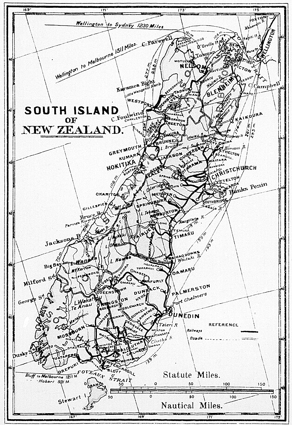
- Might be wise to wait another couple of days (see consensus note in sub-section immediately above) but, if you've already done the map, why don't you post a thumbnail of it here please, Shaundd? Thanks for your patience and cartographic efforts! -- Alice✉ 20:17, 28 February 2013 (UTC)
- OK, updated map with Queenstown-Lakes using its official territory boundary is posted above. Cheers -Shaundd (talk) 06:37, 1 March 2013 (UTC)
- The boundaries look fine to me, but the colours for Queenstown-Lakes and the West Coast are similar enough that I had to look closely. Could we swap the Otago and Queenstown-Lakes colours, say? --Avenue (talk) 14:16, 3 March 2013 (UTC)
- That's terrific, Shaundd! I particularly like the beautiful green text you've used for the National Parks - any chance of squeezing in Paparoa National Park just above Punakaiki and Nelson Lakes NP too? Because of the green text, I think you might be able to paint in Arthur's Pass NP in green instead of the blue blob too.
- If you abbreviate the "Wellington" label to "WLG" I think you will be able to change it to lie horizontally just to the right of the "Capital City star" and if you also remove the "North Island" rubric entirely, you will then have room to slide the "Cook Strait" rubric in blue to the North East so it lies completely to the North of the dotted Cook Strait ferry route in blue. These changes will then allow you to re-locate the Blenheim and Picton labels so that they lie to the right (East) of their respective dots (overlaying the ocean) and these combined changes will leave room to insert Nelson Lakes NP and even the blue of the twin lakes there...
- It would also be great if you could use the same grey italic text you've used for Milford Sound to Squeeze in the Moeraki Boulders and Akaroa.
- Finally, I've not been able to pick the correct colours to display at South_Island#Regions so it would be great if you could match them correctly - after you've made any changes, of course. -- Alice✉ 06:32, 4 March 2013 (UTC)
- No worries. I'll make those changes and swap the colours for QT-L and Otago as Avenue mentioned. I'm going to be out of town for the next few days so I'll post it on the weekend. -Shaundd (talk) 05:39, 5 March 2013 (UTC)
- The boundaries look fine to me, but the colours for Queenstown-Lakes and the West Coast are similar enough that I had to look closely. Could we swap the Otago and Queenstown-Lakes colours, say? --Avenue (talk) 14:16, 3 March 2013 (UTC)
- OK, updated map with Queenstown-Lakes using its official territory boundary is posted above. Cheers -Shaundd (talk) 06:37, 1 March 2013 (UTC)
Should The Catlins be assigned entirely to one of Otago and Southland, or be split between them?
[edit]The official boundary between Otago and Southland runs through the Catlins, with roughly two thirds of its area falling in Otago and one third in Southland. The population balance is even more skewed towards Otago. My recollection from travelling there a few years back is that the official boundary makes sense, in terms of access to services and how people think of the surrounding areas. I'd suggest the map follows the official boundary, but that otherwise (e.g. with breadcrumbs) we treat The Catlins as being within just one of the regions. I don't have a strong preference about which one. Currently it is treated as part of Southland, which might seem odd given the area and population being mostly in Otago. But the Catlins did feel more like Southland to me than Otago (except perhaps the eastern Otago Peninsula). --Avenue (talk) 15:32, 9 February 2013 (UTC)
- Excellent point!I concur. Keep the local admin boundary but breadcrumb to Southland since the majority will probably be coming from the Invercargill end and, although much of the road lies in Otago, almost all of the actual Catlins Forest Park lies within Southland regional council area. -- Alice✉ 21:20, 9 February 2013 (UTC)
List of ten "Other destinations"
[edit]I suggest that Paparoa National Park be removed from the list of "Other destinations", at least until a reasonable article is written for it. My reasons are:
- There is no article at present.
- The list contains 10 items and "The 7±2 rule is most stringently applied to lists of cities and other destinations for ... top-level regions".
Alice has suggested that if one must be removed it should be The Catlins, rather than Paparoa National Park. At this point I don't have a view on whether Paparoa is a more worthy destination than the Catlins, but I disagree with removing a half-decent article in favour of a red link (or even a stub). Nurg (talk) 08:20, 7 April 2013 (UTC)
- Good point. I'm for removing links to pages that have nothing yet. Putting them there in hope is nice, but there is no way for it to guarantee something would actually be written, and think a smaller network of working articles is better than a large network with lots of 'holes' in it. Some of the others pages in that list are pretty empty as well. Kahurangi is completely bare so maybe its the obvious choice if we must remove one?
- Maybe link to punakaiki instead of Paparoa as that has a page (and until I looked it up I did not know Paparoa was the name of the national park Punakaiki was in anyway). The list is basically just national parks anyway plus Marlborough and the Caitlins. Apart from able-tasman and mt cook most new Zealanders (myself included) don't know the names of many of the parks.
- If the list is to long perhaps on list for national parks and another for other attractions? Otherwise I would trim it and only keep the national parks which have full 'first name' recognition, say able tasman, mt cook and fiordland, and maybe generalise the others e.g. "the west coast" instead of westland park and kahurangi. But I guess what would be in that list is a whole other argument...
I agree, drop Paparoa until such time as it has reasonable content. Don't add Punakaiki in its place, because it's already linked a couple of sections up in Regions. I'd also support taking out Kahurangi NP because apart from the article saying it's in the Nelson-Tasman region, the article contains less information than the text used to link to it here.-Muscles (talk) 23:01, 8 April 2013 (UTC)
Alternative banner for this article?
[edit]

I created a new alternative banner for this article (I initially created it first and foremost so that it would be used at the top of the parallel article in the Hebrew edition of Wikivoyage, yet I later decided to also suggest that the English Wikivoyage community would consider using it here as well). So, which banner do you prefer having at the top of this article? ויקיג'אנקי (talk) 04:39, 23 September 2015 (UTC)
- I'm kind of undecided. The current banner is brighter, but the alternative banner isn't hazy or out of focus. Is it used in any other article? I guess I ultimately favor the alternative banner. Ikan Kekek (talk) 04:48, 23 September 2015 (UTC)
- Second is better, the colours are more vivid and it is more inviting (to me at least). – Hshook (talk) 14:04, 23 September 2015 (UTC)
- I don't think the new suggestion is a real improvement. While the current banner is hazy, the new one has 1/3 in shadow. Keep. Danapit (talk) 21:03, 23 September 2015 (UTC)
- Second is better, the colours are more vivid and it is more inviting (to me at least). – Hshook (talk) 14:04, 23 September 2015 (UTC)
- Proposed is a better image. --Andrewssi2 (talk) 01:05, 24 September 2015 (UTC)
- I am fairly undecided between the old and new banners. However West Coast (New Zealand) doesn't have a banner, and I think that the new one could be used there (I am not 100% sure as it is hard to figure out the region borders in open country). AlasdairW (talk) 21:20, 24 September 2015 (UTC)
- That's a much better solution than substituting one more or less good banner for another. Ikan Kekek (talk) 21:40, 24 September 2015 (UTC)
- Mm, technically both banners are in the same Canterbury (New Zealand) region. And while the Tasman Glacier is just over the mountains from the West Coast, those same mountains mean it's easily a five or six hour detour to get there by road (helicopter is a different matter :) Any banner for the West Coast needs to capture the feeling of isolation, even by NZ standards. I find the current banner to be too hazy, but can't say I like the proposed one any better. -- torty3 (talk) 06:00, 25 September 2015 (UTC)
- I think that the new one may have the wrong co-ordinates in commons - it is shown as being on the Wangapeka River, and there is no water shown on the map big enough to be the lake in the picture. (Confusion between Tasman Glacier and Abel Tasman NP?) And if the co-ordinates are correct then technically it is in Nelson Bays. So scrub the idea of using it for West Coast (New Zealand). AlasdairW (talk) 16:43, 25 September 2015 (UTC)
- I have corrected the co-ordinates. It is Tasman Lake in the Mackenzie District of Canterbury. If not used here, it could be used for Mackenzie Country, which does not have a banner. Nurg (talk) 23:17, 25 September 2015 (UTC)
- Second, too bad the left is not sunny. Syced
New banner
[edit]Here's some banners that I've cropped. The issue with the current one for me is that it's a little hazy. SHB2000 (talk | contribs | meta.wikimedia) 08:24, 23 October 2021 (UTC)


- I think all of them are fine, and thematically they are equal to the current one. –LPfi (talk) 09:49, 23 October 2021 (UTC)
- I think banner 3 is the best for proportion. Banner 2 would be my second choice. --Comment by Selfie City (talk | contributions) 16:21, 23 October 2021 (UTC)
- 2, 3, 1, although they are all good. I would prefer to avoid 5 as it is so similar to the one on Mackenzie Country. AlasdairW (talk) 20:02, 23 October 2021 (UTC)
- After previewing them on the page, I rank the best in order 3, 2a, 1. One factor I considered is the way the page title looks on the top left of the image (in my browser). Also I like the direct sunlight (plus shadow) of 3. Nurg (talk) 00:22, 24 October 2021 (UTC)
- All of the new ones are great to me and all are better than the current one. I'll be happy with whichever one gets the most votes. Ikan Kekek (talk) 09:22, 24 October 2021 (UTC)
- There seems to be consensus for three.
 Done SHB2000 (talk | contribs | meta.wikimedia) 11:49, 24 October 2021 (UTC)
- There seems to be consensus for three.
- All of the new ones are great to me and all are better than the current one. I'll be happy with whichever one gets the most votes. Ikan Kekek (talk) 09:22, 24 October 2021 (UTC)